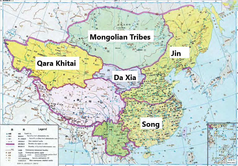
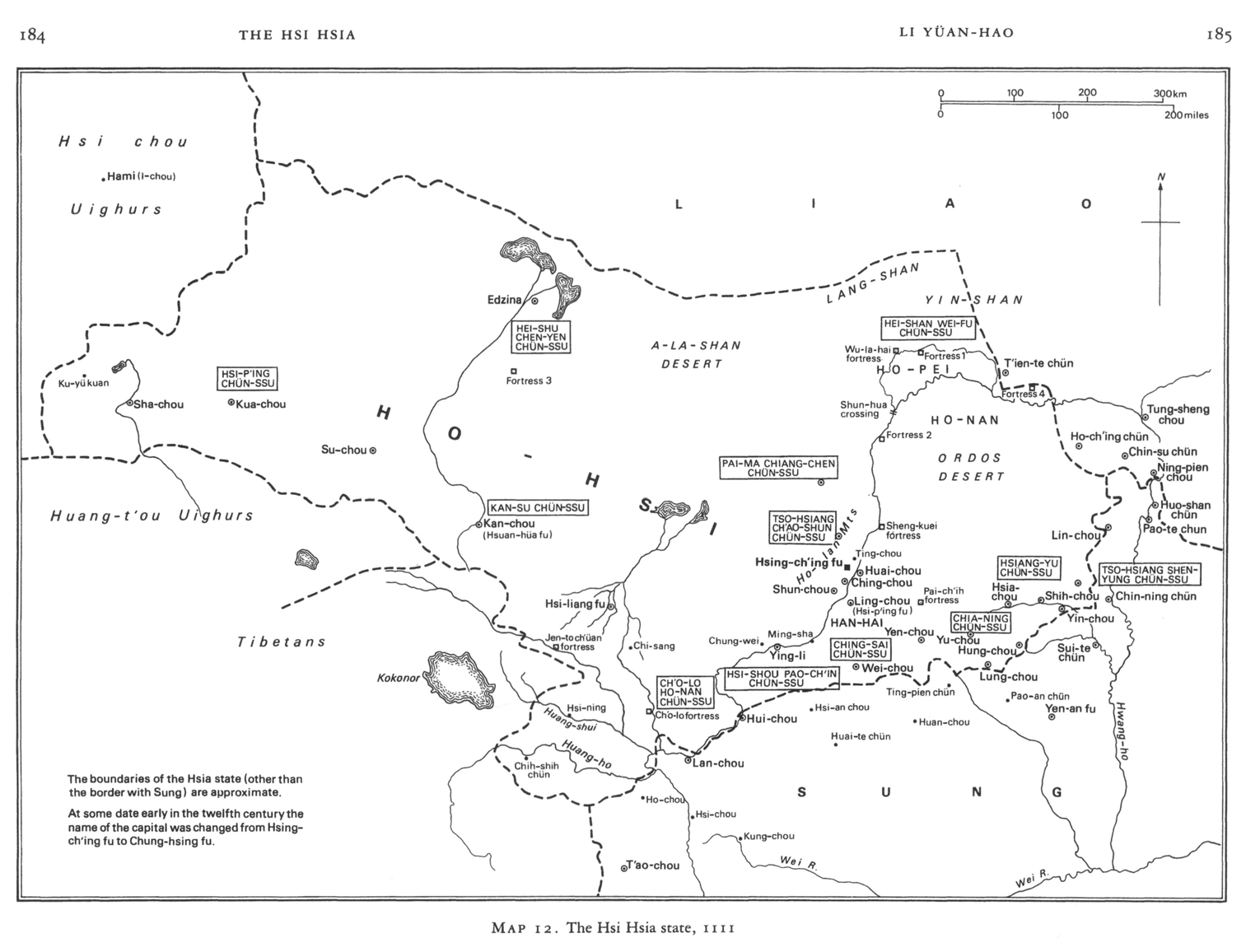
The locations were a little bit abstract when I was carrying out the research and I realise that this is probably the case for anyone listening, so here are three maps of the Tangut state. There is some uncertainty relating to some borders, cities and military centres so I would not consider any of them to be 100% correct – but they are a useful guide.
|
|
| A map of Da Xia c.1111, taken from Ruth Dunnell’s chapter The Hsi Hsia in Twitchett, D., Franke, H., and Fairbank, J.K. (eds.) The Cambridge History of China: Volume 6, Alien Regimes and Border States, 907-1368. Map 12, p 184. |
|
|
| East Asia c.12th century – showing the Qara Khitan, Tangut, Jin and Song states, and location of Mongolian tribes. Taken from, Jinbo Shi (2021) The Economy of Western Xia: A Study of 11th to 13th Century Tangut Records. Translated and Edited by Li Hansong. Brill: Leiden. Figure 10, p39. Modified by Corey Still, Mongol Empire Podcast (2026). |